In which I am amazed by skylark song and learn some New Forest history
On it [Hampton Ridge] runs straight as a die through some of the wildest, finest country we know in the north of the New Forest.
Joan Begbie, Walking in the New Forest, published 1934
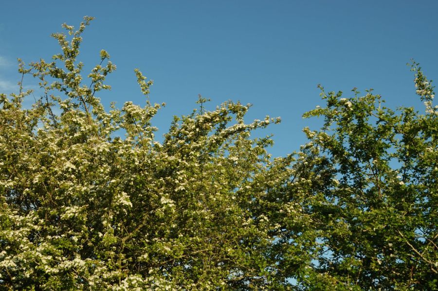
In this post, I accompany Joan Begbie and her two dogs (Bill, a white bull terrier, and Mr Bundy, a diminutive griffon) on a walk she describes in her 1934 book, Walking in the New Forest. This circular walk, starting at Abbotswell and following Hampton Ridge before turning into Amberwood, has become one of my favourites. It is a creditable but not over-taxing 5.5 miles long, and takes in far views, heaths and heathland birds, woodland, streams and open grassland, as well as some local history. There’s so much to see and think about, that I’ve divided my description of the walk over two posts, with the second half of the walk to follow next week. Joan, Bill and Mr Bundy visited on a windy and frosty day in late winter. I was walking in late May in gloriously warm sunshine, with the hawthorn in full blossom, but I have also walked here in colder months. It is beautiful in any season. (If you have a copy of Joan’s book Walking in the New Forest, then turn to pages 26 to 33 for Joan’s description of the full walk, including Amberwood and Latchmore Bottom.)

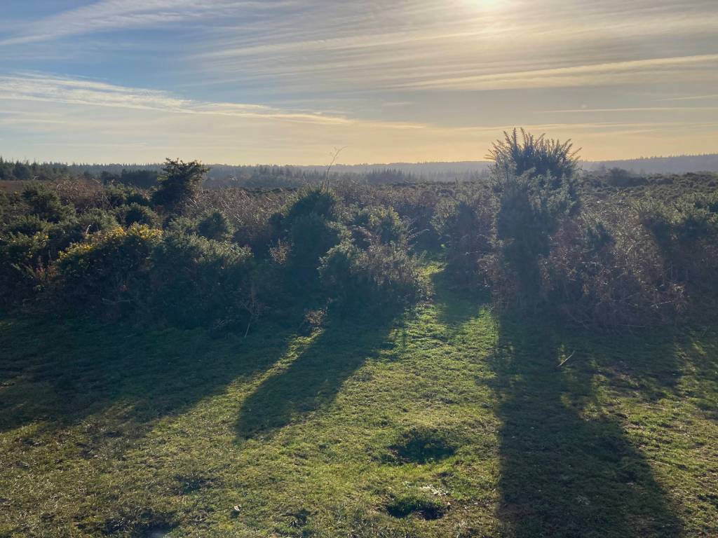
Hampton Ridge
In Walking in the New Forest, Joan describes arriving and parking her car, which she calls Miss Riley, at the western end of Hampton Ridge on a cold and windy day. She makes her way along the first part of the track, which rises upwards from close to what is now Abbotswell Car Park, near Frogham.
At the top the north-easter filled my eyes with tears at the first stinging encounter and made it impoosible for me to park my handkerchief for the rest of the way. But I did not mind, for who could mind trifles with country, beautiful even when blurred by wind-born tears, lying all round, and with a good manly track to carry you high up through the heart of it?
Joan Begbie, Walking in the New Forest
Anyone who has ever made their way along Hampton Ridge on a windy day will be nodding in vigorous agreement with this description. The Ridge towers over the heaths and woods to either side and is very exposed. Even on a relatively still day in late May, when I was walking, breezes cooled the warmth of the sun. But, as Joan says, it is worth both the climb and the chill to experience the all-encompassing views across the northern Forest. To the south, the heath drops to Latchmore Bottom and then up to Hasley Hill with its crown of trees. To the north, there is Pitts Wood Inclosure and the country round Godshill and Ashley Walk beyond.
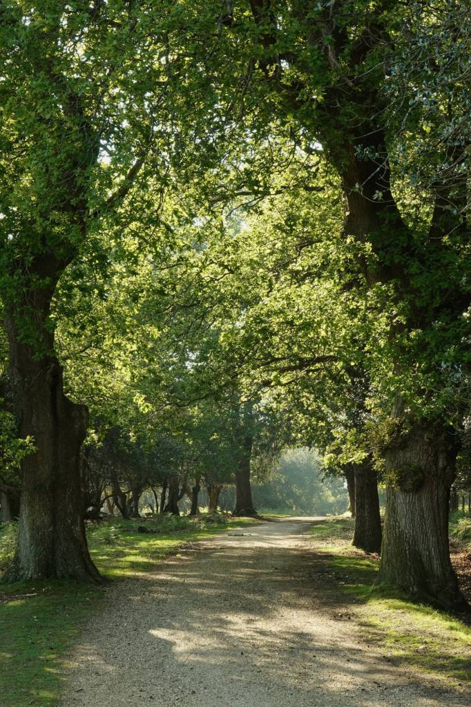
The start of the Hampton Ridge track in May 
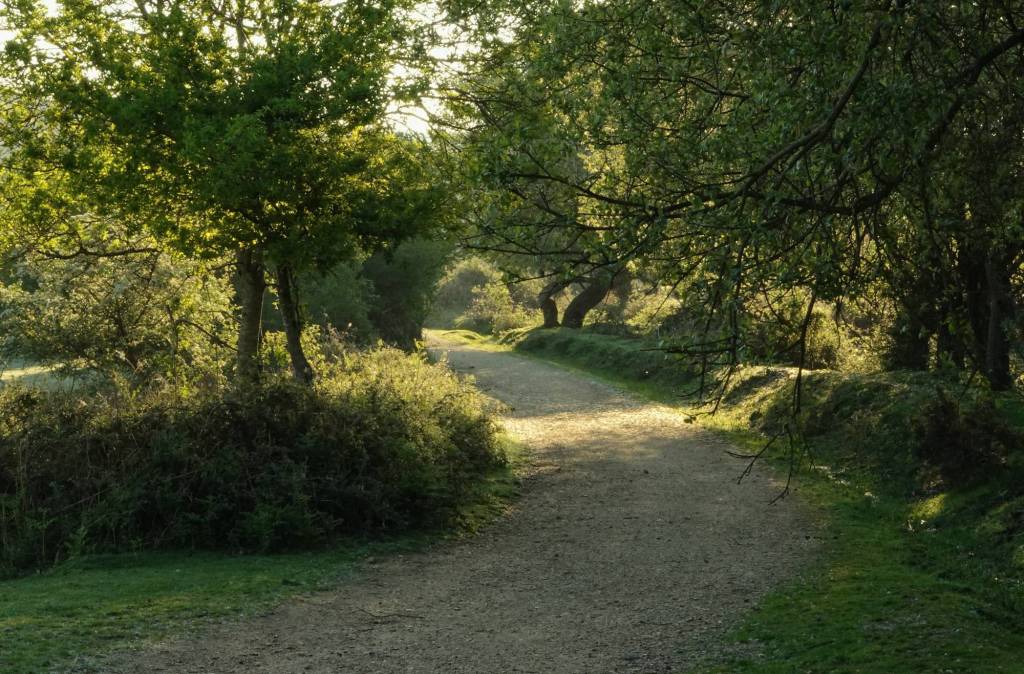
The start of the Hampton Ridge track in December
Joan’s ‘good manly track’ is now a well-used cycle route, running all the way from Abbotswell to Fritham. There are some lovely walks along it from Fritham, and I’ve walked that way with Joan, Bill and Mr Bundy before, to explore the tall trees of Islands Thorns. However, while the eastern half of Hampton Ridge is all about the woods, here, in its western reaches, it’s about heathland and wide, open landscape.
Skylarks and Curlews
Hampton Ridge is also full of birds and, on my May walk, full of their songs. There are Chaffinches, Sparrows, Blackbirds, a Robin, and also a Linnet, which I’ve recently learned to identify. Cuckoos call in the distance, their two-note song sounding from wood to valley to heath. More than anything, though, the sky is dazzled by the songs of Skylarks. Sometimes I hear two or three in the air at once; at other times, as one parachutes down on spread wings, still singing, another rises and begins its own song. They fly so high that it is hard to spot them, particularly with the bright sun in your eyes.
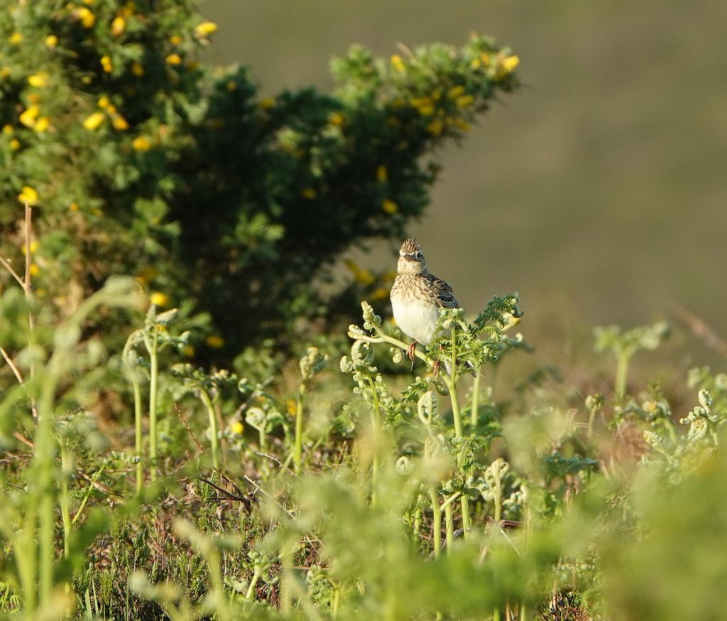
Skylark 
Curlew
Joan mentions that Black Grouse (which she calls by an alternative name of Blackcock) was found in the heaths around the Ridge up until the early twentieth century. The southern England populations were certainly extinct by the 1960s, so it’s just possible there may still have been a very few around in the New Forest when Joan was walking, but they would already have been in serious decline. Joan also hopes that one day she might hear “the lovely, melancholic whistle of the curlew” above the Ridge. This is another bird that has been rapidly declining in the New Forest; there are currently about 45 breeding pairs. For an insight into the problems facing these charismatic birds, in the Forest and elsewhere, and what’s being done about it, you should read this blog post on the Curlew Recovery Partnership website written by its manager Russell Wynn (Russell is also the co-founder of local organisation Wild New Forest). As for the Skylarks, while they appear to sing across the Ridge’s sky in large numbers, they are also declining and of conservation concern. In the UK as a whole, the Skylark population halved during the 1990s.
These are sobering thoughts. I am reminded that Joan is walking and writing in the 1930s, before the post-Second World War agricultural intensification that has affected the UK and much of Europe since. The New Forest may be a protected landscape, where traditional commoning and farming practices prevail, but it is not immune to the pressures we are placing on the natural world.
The Hampton Ridge trig pillar
However, for today, let’s enjoy the bracing walk and views from Hampton Ridge, because we are about to learn something of the local history with which it is associated. The Ridge was used by Bronze Age people, and their barrows are dotted around, but it is to more modern events that we turn. In fact, the signs of this history date to a few years after the time that Joan was walking through the New Forest with Bill and Mr Bundy.
Firstly, walking along the Ridge I see, just to the left, one of the Ordnance Survey’s trig pillars, which marks a spot 100 m above sea level.
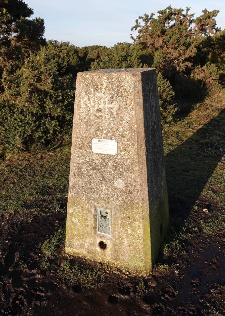
The trig pillar on Hampton Ridge stands at 100 m above sea level.
I’ve been reading a little about the history of trig pillars (find out more on the Ordnance Survey website). The project to erect them began with the first in 1936, at Cold Ashby, and ended in 1962, at Thorny Gale in Westmoreland. I won’t pretend to understand the maths, but the triangulation they enabled meant that the accuracy of maps vastly improved. Now, modern technology means that the pillars are largely redundant, but walkers and cyclists still consider them beacons in the landscape.
There would have been no trig pillar on Hampton Ridge when Joan was walking. Neither would there have been any sign of the next bit of twentieth century history that I found, just a little further along.
When is a tumulus not a tumulus?
On my first walk along Hampton Ridge back in December, I didn’t even notice the trig pillar. Instead, I was heading for one of those mysterious Ordnance Survey map annotations, Tumulus, always written in curly lettering, presumably to indicate great age. Sometimes you find the tumulus, sometimes you don’t. This one was marked on the map just off to the south by a few steps, so I was hopeful, especially as a well-trodden path veered towards it.
I didn’t find a Bronze Age tumulus. I found this.
The Ashley Walk Bombing Range was operational from 1940 until 1946, and was used for target practice by aircraft from RAF Boscombe Down, Salisbury, as well as explosive and bomb testing. There were airstrips, control and observation towers, as well as different target types within its boundary, which enclosed a total of 5000 acres. The concrete arrow I found next to Hampton Ridge was a directional arrow, pointing towards an illuminated target to the south for night raid practice. For an informed overview, do visit the New Forest Knowledge website, where there are also links to videos and more detailed articles.
At the time I first stumbled across it, new to the area and with no inkling of the New Forest’s Second World War history, the large concrete arrow was a bit of a shock to me. On this most recent visit, I have sought it out. It should be an anachronism in the heart of the wild heathland country of the northern New Forest. What place does a remnant of human war have amongst the heather and trees and the birds on a peaceful and warm day in spring? But, as I stand here, looking across to Hasley and the skies beyond, it doesn’t feel wrong at all. Early human history created the heathlands, after all, so why shouldn’t there be a memory upon the earth of our more recent deeds, for better or worse.
Local people cleared the arrow of vegetation a few years ago, and now heather, bracken and grass are fingering its edges and softening its impact. For Joan, the concrete arrow, the bombing range and, of course, the Second World War, are in her future, though not so far off. In my imagination, we stand together either side of one of the greatest conflicts in recent human history, and yet for each of us the tree-dotted heathland still sweeps away to the horizon and Skylarks are singing in the sky.
Another tumulus that is not a tumulus
A little further eastwards, and the map again marks a tumulus. Not only is it on the map, but I can see it from the Hampton Ridge track. It’s quite large. I turn to Joan, to see if she and the dogs want to turn aside from the main path to visit it with me, but she looks puzzled. Yes – this is again a relic of the bombing range, and invisible to Joan. Officially known as the Ministry of Home Security Target, it was locally known as the Submarine Pens, or Sub Pens for short. Built in 1942 of reinforced concrete on a heavy duty foundation, its local name derived from a belief that it was supposed to be a replica of the German submarine pens along the French coastline, which were a bombing target. It was, in fact, possibly intended instead to test concrete reinforcements for air raid shelter designs. For anyone interested in this piece of Second World War history, local historian Henry Cole has undertaken some detailed research, available on the New Forest Knowledge website.
When the bombing range was dismantled, it proved impossible to demolish the Sub Pens. Instead, it was covered with earth, and now gorse and grasses are reclaiming it. I have found ponies grazing its flat summit, and watched deer leaping across the heath below, oblivious to my gaze. The view is wonderful.
Into Amberwood
We had meant to follow the track’s left fork right round past Island Thorns to Telegraph Hill, but we had reckoned without Amberwood.
Joan Begbie, Walking in the New Forest
I rejoin Joan and the dogs on the main track, and the tall trees of Amberwood Inclosure draw near as we walk on. Oaks gather round the path. I can see why Joan abandoned her plans to continue on northwards, and instead turned aside to discover the secrets of Amberwood. I follow her in.
Next week, we will continue this delightful circular walk into Amberwood, where we will find woodland flowers, an enchanting brook and a haunted wood.