In which I start in rain, end in sun, discover some history and think about old placenames
Church Place has about it the air of a deserted garden. Its rides are mostly so overgrown that one has to push through bushes to keep to them, but it is full of sun, charming young trees, and fine old ones.
Joan Begbie, Walking in the New Forest, published 1934
In this and the next post (to be published next week), I accompany Joan Begbie and her two full-of-character dogs (Bill, an exuberant white bull terrier, and Mr Bundy, “a rough-haired brindled griffon of diminutive size and choleric disposition”– Joan’s words) on a walk which starts at Deerleap Inclosure, and which she describes in her 1934 book, Walking in the New Forest.
I’m cheating a little. Joan started and ended her circular walk about two and a half miles further south as the crow flies, at Pig Bush. However, on comparing the modern map with one from her time, I could see that some of the paths she walked between Pig Bush and Deerleap had disappeared. I didn’t feel very confident about finding an alternative way through probably boggy ground, especially as I was walking in late autumn (autumn in the New Forest brings golden beauty but also squelchy muddiness, and the mires are sensitive habitats). Joan and the dogs were walking in spring, so they had no such fears (and they also had paths to follow).
I will go back to explore the places around Pig Bush in warmer weather. In the meantime I met up with Joan, Bill and Mr Bundy at the Deerleap Inclosure car park, by which time they had already got a few miles under their belts (or collars). If you have a copy of Walking in the New Forest by Joan Begbie (pub. 1934) and want to read about her circular walk from Pig Bush, which includes a good part of the walk I took, then turn to pages 216 to 228.
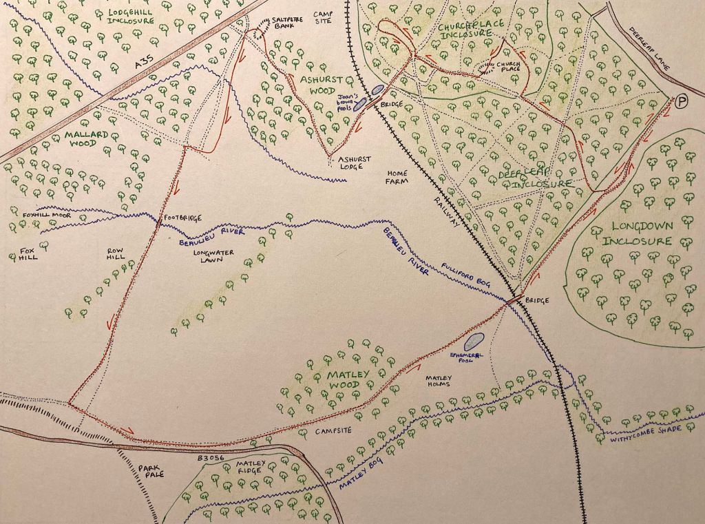
Deerleap Inclosure
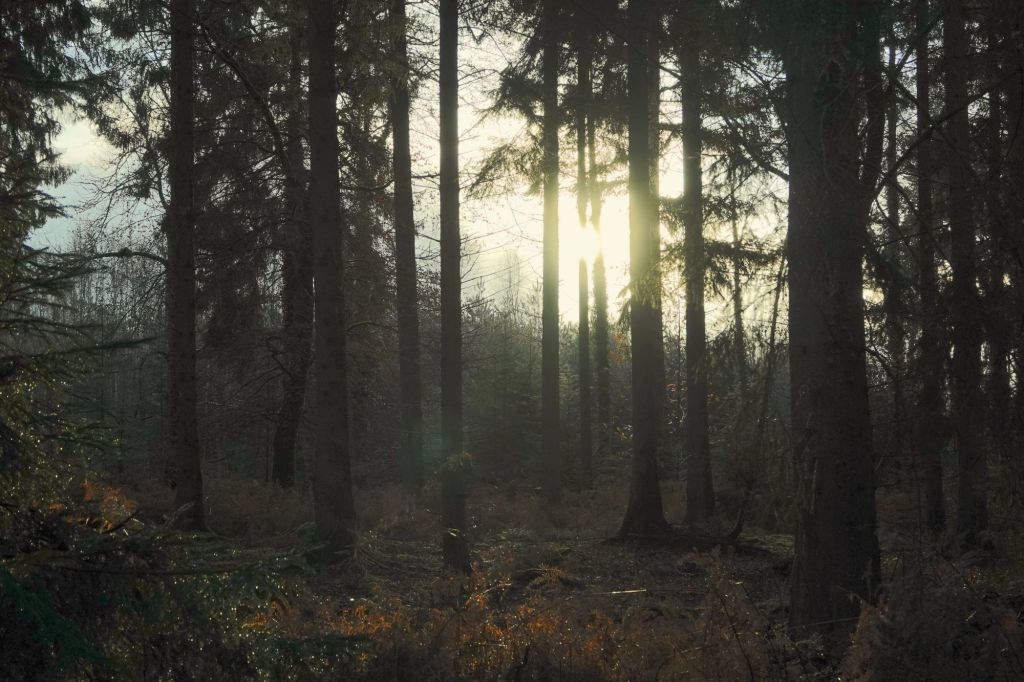
The forecast promised early drizzle and then sun and cloud. As I park, it is raining in a showery steady kind of way, and I wait a short while, listening to the radio and looking out into the trees of Deerleap Inclosure through a water-splattered windscreen. Leaving the car, I realise it has almost stopped raining, and possibly lessened a few minutes ago; many of those drops are falling from the trees above, not the sky.
Here come Joan, Bill and Mr. Bundy, and we set off together, walking outside the eastern edge of Deerleap with its tall conifers peering over its restraining fence. Crows caw greetings, ponies ignore us, and Scots Pines tower above on the open land to our left, their branches spreading in welcome. A Pied Wagtail bobs its tail as it hops away. Birches at the Inclosure’s edge are still holding their leaves, flickering with fragile golden notes against their dark-speckled white trunks. The air smells damp and fresh; the sounds are of breeze, bird calls, road noise from the nearby A35 and, every few minutes, the hooting of a train as it speeds along the nearby railway track. The railway was built in the mid-nineteenth century, so Joan would have passed it in her own time: I wonder what sound it called then? I usually hate intrusive traffic and railway noise but, for some reason, I don’t mind so much today. There is calm in the breeze from a deeper, liminal world that is more immanent among the trees and in the air than modern, transient interferences.
The rain properly stops, and we turn through a wooden gate into Deerleap. The Inclosure was first planted in 1867 on the site of what had been old pasture woodland, extending the older Church Place Inclosure. I sometimes experience grief for the ancient woodlands that have disappeared over the centuries, victims of the plantations, originally established for shipbuilding, now for forestry. Some remain, and are beautiful, but I long in vain to walk beneath the shade of ancient deciduous woodland from edge to edge of the New Forest. Here in Deerleap, though, it seems the old wood is creeping back in a higgledy mix of birches and oaks among the conifers. It is being managed by the Forestry Commission as a mixed woodland: I wonder what it will look like a hundred years from now?
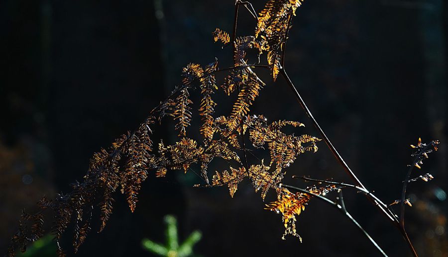
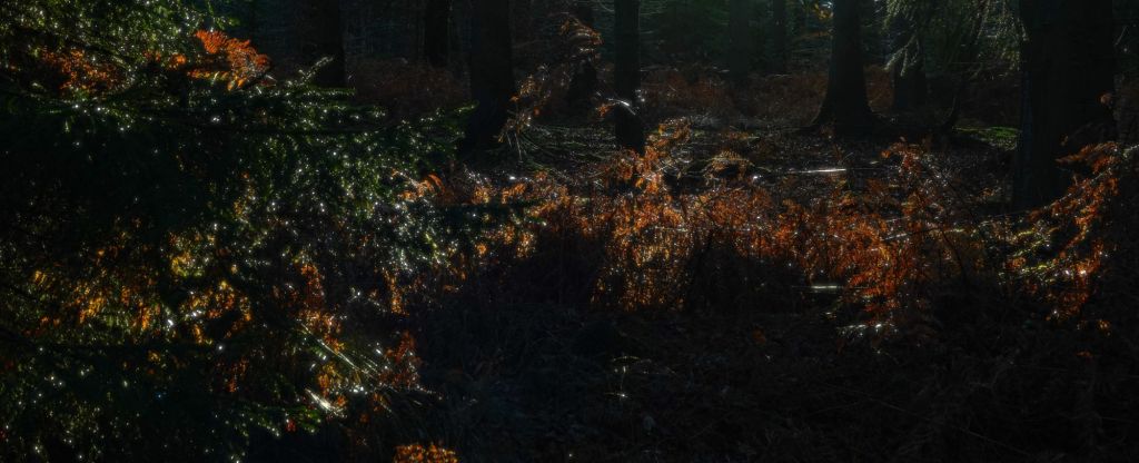
The old ditch and bank of the original inclosure, moss-covered, keep pace with us along the leaf-buried path. We cross a wooden bridge, after which bronzed clumps of grass and bracken light the still dull day, before joining the cycle path that heads towards Churchplace Inclosure. Four Fallow hinds cross the way ahead of us, fairly unperturbed by the presence of humans and a barking dog – I had just passed a lady and her dog (which she was keeping carefully under control), and I smile as I imagine both Bill’s exuberant reaction to deer and Joan’s own love of them.

Churchplace Inclosure and some old names
It’s easy to imagine how Deerleap may have got its name. On the old Drivers’ map (both the 1789 and 1814 editions; the map is named for two of its creators), the place near where we started from is marked as The Deer Leap, and Deer Leap Gutter runs southwards from it (not marked on the modern OS map, but I imagine this is the stream running through the western edge of what is now Longdown Inclosure). The southern area of the modern Deerleap Inclosure is named Ashen Hill on the Drivers’ map.
But what about Churchplace Inclosure? Its name derives from the site of a mediaeval royal hunting lodge within its boundaries, called Church Place. It was never a church: this and similar sites were so named by local people of later history who believed incorrectly that they were the remains of villages and churches destroyed by William the Conqueror (the New Forest Explorers Guide website tells more about this). The 1814 edition of the Drivers’ Map shows the brand new inclosure – it was established in 1810 on the site of a large area of pasture woodland, with Crook Hill and Crook Hill Lawn just to the north (retained as the name of Crookhill Railway Bridge, the footbridge that crosses the railway track from Churchplace to Ashurst Wood).
I was intrigued by one name, given on both the 1789 and 1814 editions of the Drivers’ map. Ashurst Lodge, just to the west, is subtitled The Rails, and the land between it and what is now Churchplace Inclosure is named as Rags Without the Rails. The railway that separates Ashurst from Churchplace hadn’t yet arrived, so is nothing to do with it. I went on a little book-ish and internet exploration, and discovered firstly that Rails was a term referring to the outer enclosing boundaries of old lodges, such as that at Ashurst (see Nicola Smith, 1999). I already knew that without in this context means outside, but what does rags mean here? I wonder if it was a shortened form of ragamuffin, an old English word, and that rags without the rails (i.e. outside the lodge boundary) refers to one of the small settlements of illegal squatters on Crown Lands in the mid seventeenth to eighteenth centuries (see Antony Pasmore’s New Forest Notes of July 1994 for a description of the similar origin of East Boldre village). I couldn’t confirm this, though – if any readers can throw light on the name, please do! I will continue to try to find out.

Church Place: a mediaeval royal hunting lodge
Mysterious brooding on old names aside, we turn into a muddy ride through Churchplace Inclosure, here unfenced. Birch, oak and beech edge aside the conifers, and the sun has finally come out properly, glinting like fairy lights on coppery bracken in the undergrowth. A gang of Coal Tits dash and dip their way past, and we find an oak and holly growing so closely together that it is as if they are conjoined. I understand why Joan describes the Inclosure as a “deserted garden”, and determine to return here in spring, to see what flowers grow beneath the trees.
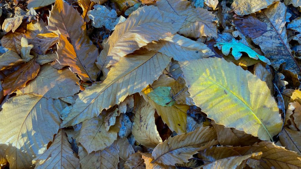
We follow the ride round to the left and, when we get closer to the site of the royal hunting lodge, turn off the path to find it, our feet and paws crunching through the fallen leaves of oak, beech and sweet chestnut. Even fallen, the leaves remain vibrant, shining with different colours and filling the air with a crisp, fresh scent that is only just bordering on decay as life continues its cycle of the seasons. The site of the hunting lodge is nothing more now than a raised platform, with some old ditches round its edge. The wood has reclaimed it, and the lords and squires that hunted here are barely even a memory. This is now a peaceful place, of safety and regeneration.
We scramble through a holly grove to rejoin the cycle path, turning right on to it. Ahead, we can see a planting of saplings, protected in sleeves, and we walk down another ride to take a look. The beginning of this ride has been taken over by young naturally regenerating birch, but we soon find the path and follow it round. The second part of this detour from the main track hasn’t been used for a long time: its route is only marked by old vehicle tracks imprinted deeply in the soil, now covered in moss, lichens and ferns, with ankle-turning pits and hollows.
Eventually we find our way back onto the cycle track and arrive at the railway bridge. I pause for a while at its crest, and watch as a highspeed train careers below.
On the other side of the bridge under the oak trees fringing Ashurst Wood is a big brown pool filled with golden waterlilies.
Joan Begbie, Walking in the New Forest
The brown pools are still there, still fringed by oaks, but I will need to return in another season to look for golden waterlilies.
At the western side of the railway bridge, we find ourselves in lovely Ashurst Wood, looking forward to travelling north towards Mallard Wood, and then south again to the Beaulieu River and Matley. For now, we will leave you, enjoying the stillness and breathing the fragrant air at the wood’s edge, but there will be more exploring next week as we continue this peaceful walk.

